Catching up 1 – tracks

Breaking the long posting hiatus with some pictures from weekend activities.

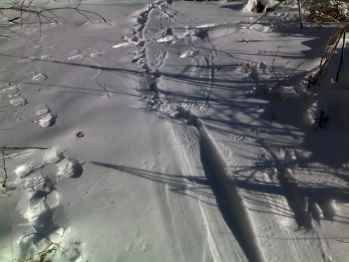
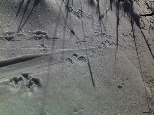
I took a long scouting walk around a salt marsh a couple weeks back and chanced upon this set of tracks in the snow. My theory is that they show a coyote’s attempt to drag down a white-tailed deer. He wasn’t successful here, but I didn’t follow the tracks to find out what happened next – I was like a horse that knows the barn is thataway – heading for the truck!

*

Flying Merkel

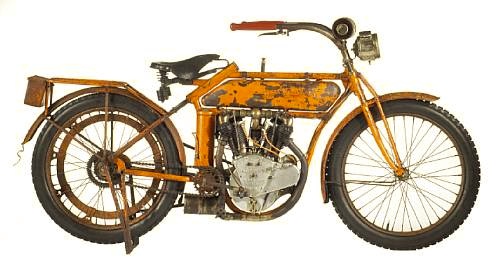
As mentioned before, I have a soft spot for these beasties.
*

Road or track, it was difficult to ignore a Flying Merkel, and not just because of the brand’s signature bright-orange paint. Merkels displayed perhaps the finest engineering of early American motorcycles, with components that were literally years ahead of their competitors.

Credit for that goes to founder Joseph Merkel, a self-trained machinist who went on to study mechanical engineering at university. A motorized tricycle he built in 1900 is credited with being one of the first self-propelled vehicles in Wisconsin. Soon after he was in the business of selling motorcycles. Where others were happy with bronze bushings inside their engines, Merkel insisted on German-made ball bearings, which quickly led to a reputation for reliability. Likewise, in contrast to the standard atmospheric pressure intake valves, Merkel designed a cam-actuated valve mechanism for both intake and exhaust. He also developed a throttle-dependent engine oiler way before Harley or Indian adopted that useful feature.

Merkel then turned his attention to suspension. Bone-jarring rigid frames wouldn’t do for Flying Merkel customers, so he designed telescoping systems at both ends with concealed springing. The so-called Spring Frame and Spring Fork gave his bikes an unsurpassed ride, leading to the advertising slogan, “All Roads are Smooth to The Flying Merkel.” The forks in particular were so good that many a competitor’s bike turned up wearing a complete Merkel front end! *

Via Hemmings.

Kayaking the Tsangpo Gorge

Seems like once something is front and center in your imagination, you find it everywhere. I finally ordered Atomic Robo (Vols. 1-3) – I opened up volume one and found myself at a Nazi installation in the Tsangpo Gorge! A few days later I was skulking around a local used bookstore when I came across The Last River, an account of the ill-fated 1998 kayak expedition that claimed Doug Gordon’s life. Like the ijit I am, I didn’t buy it immediately; when I returned a week later it was gone. Luckily, it hadn’t sold – just moved to the ‘featured used books’ shelf at the main store – I snatched it up. The Last River gets 2 1/2 out of 5 stars – in spite of (because of?) the extensive bios of the participants, I didn’t empathize with any of them. Some of it may also be my ambivalence about modern ‘extreme’ expeditioning. It was extremely useful as an overview of some of the other western personalities kicking around that part of the world: Ian Baker, Kenneth Storm, et al. and as a decent timeline of western activity in the late 90s though.

While wandering around the internet looking for info on other Tsangpo exploration, I found the video account of the 2002 expedition on Hulu. Some thoughts –

  • Anyone who does not expect to have to re-negotiate with Monpa porters when the porters feel they have the upper hand is not paying attention. It happened to Kingdon-Ward in 1924, to the 1998 kayakers and, as you’ll see below, in 2002.
  • The river volume in 2002 is low – and yet the water is still amazingly powerful and complex. Some of it has to do with the gradient and some with the fact that ‘low’ is a relative term.
  • I can’t imagine what the holes, hydraulics etc. would be like at 2 1/2 to 5 times the volume depicted below (the conditions that the 1998 group confronted). Mind = boggled.
  • If you have Google Earth installed, plugging 29°46’9.59″N, 95°11’13.33″E into the search box will fly you  (close) to the Hidden Falls.

  • The map graphics in the video confuse the heck out of me – all I can figure is that south is at the top of the map.
  • Takin.