The San Diego Model RR Museum

My post Clovis-flyabout time in Arizona was uneventful: some time boondocking near a ghost town and a week and a half at Kartchner Caverns SP. I’ve driven by signs pointing the way to KCSP for years and never bothered to look into it – turned off by eastern tourist trap caves I guess. This time round, I was looking for a campground near the southern AZ grasslands and gave KCSP a whirl. The campground in nice, but OMG the caves! Discovered in 1974, kept secret for 14 years, and developed prioritizing the cave environment; just incredible. If you visit when the bats are elsewhere (they close part of the cave during bat season), the Big Room tour is my recco.

From S AZ, it was off to San Diego. I had 2 spots on my high priority list. The San Diego Model Railroad museum was the first. They have multiple layouts: O, HO and N – I was there for the La Mesa Model RR Club’s HO scale Tehachapi layout. So, early on a Tuesday morning, I hopped on my bike and pedaled to Balboa Park. My plan was to be there when they opened and get some more-or-less quiet time before it got crowded. Ha! By the time they opened, I was one of a couple dozen people at the front door. It got crowded quickly and I’m still crowd-averse so I only spent and hour and a half or so inside, but it was time well spent.

The Tehachapi Loop is a famous track spiral in south central California. By spiraling, the railroad gains horizontal distance so that it can keep the vertical grade manageable, but the v cool visual benefit is that any reasonably long train ends up passing over/under itself. The La Mesa folks have modeled it, and modeled it  well. I read somewhere that this layout is the largest model RR representation of a prototype in the world.

Headed west to the loop.

A westbound freight headed by 2 SP SD40T-2 tunnel snoots bracketing a UP U30C with an SP SD39 bringing up the rear.

*

Through the loop!

The same train running downhill through the loop.

*

CTC panel

And just for grins, a shot of one of the CTC panel displays.

Between the museum, Balboa Park and a very interesting waterfront bike ride, an A+ day.


Q: What time is it?

A: You mean now?

I chanced on this WaPo piece on the health effects of being on the west edge of a time zone and it resonated with something I’ve been thinking about a bit. My daily activity is matched to actual sun position; earlier in the trip the question was, “When will the sun be high enough to warm the tent?” and over the past week, as temps have pushed triple digits, the question changed to, “When will there be enough light to break camp and head out before the sun does its inferno thing?” Depending on where I am in a time zone, the sun/wall clock time match can be no big deal, or a bit of a problem. I noticed it most in west Texas because the sun didn’t set ’til extra late (wall clock time) and stores tended to close relatively early, thus I needed to pay attention to resupply concerns well before I was ready to wrap up the day’s ride. And start times were a little jarring, too – getting up with the sun but not being on the road before, say, 9:30 felt odd. It’s worth keeping in mind that standardized time was very much a product of the industrial revolution, especially railroads. As much as I love trains, I have to give the whole enterprise a failing grade There’s an aspect of fetishization – valorizing wall clock time (and the scheduling needs of capital) over the health and safety of human beings. I’m not saying we should throw the clock out the window, but the notion that folk’s schedules should have no connection to their circadian needs is BS. Howard Mansfield wrote a good book about the development of standardized time: Turn and Jump – recommended.

Before I turn and jump to the travelogue, one more time zone note. Coming into Portal, AZ, my phone kept switching time in hour increments. I couldn’t figure what was going on until I remembered that Arizona, with the significant exception of the Navajo Nation, does not observe Daylight time, so they’re effectively on PDT in the summer. Duh. I’m guessing time zone wobble on one’s cell phone is a pretty bike-tour specific malady: in a car one is going fast enough to switch from towers in one time zone to another definitively, hiking one is traveling slowly enough to do the same, but on a bike, especially moving north/south on a boundary, time, um, changes.

Sunset

More…

Continue reading

“The river was cut by the world’s great flood and runs over rocks from the basement of time.”*

As far as I can remember, “The Saturday of Marten Van Kleek” was what first stimulated my interest in historical and buried landscapes.

Even though the nearest big city, Boston, has an enormous amount of new land (check this map (.pdf) of the tiny town as of 1645), I’ve always been especially interested in subterranean rivers and Boston, with the Fenway and other salt marshes, just doesn’t have much to offer. The really big city just beyond Boston does, though.

..We had a lantern to pierce the cellar darkness and fifteen feet below I clearly saw the stream bubbling and pushing about, five feet wide and up-on its either side, dark green mossed rocks. This lively riverlet was revealed to us exactly as it must have appeared to a Manhattan Indian many years ago.

With plum-bob and line, I cast in and found the stream to be over six feet deep. The spray splashed up-wards from time to time and standing on the basement floor, I felt its tingling coolness.

One day I was curious enough to try my hand at fishing. I had an old-fashioned dropline and baited a hook with a piece of sperm-candle. I jiggled the hook for about five minutes and then felt a teasing nibble. Deep in the basement of an ancient tenement on Second Avenue in the heart of midtown New York City, I was fishing.

Feeling a tug, I hauled up in excitement and there was a carp skipping before me, an almost three pounder. I was brave enough to have it pan-broiled and buttered in our upstairs kitchen and shared it with my brother…*

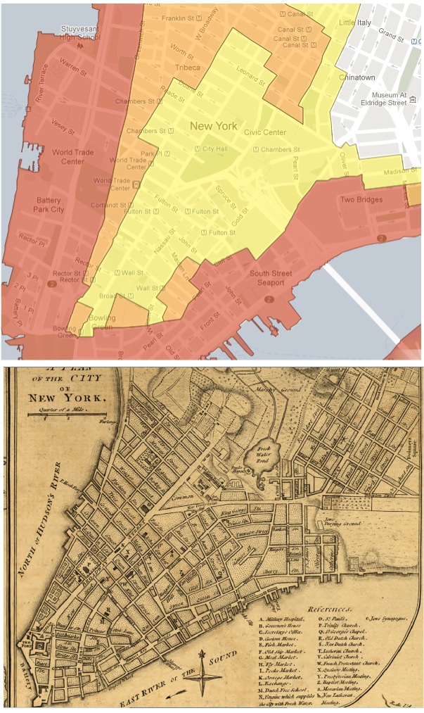
Last October, when Sandy hit, I was concerned about my son. He lives in Brooklyn – quite a ways away from the water, but that didn’t stop me from worrying. I didn’t know if perhaps he was in the middle of an old ravine or a bowl that held a pond way back when. Off I went to the evacuation map where I found that he was in good shape. I wasn’t crazy – here’s a graphic ganked from Manhattan Past’s ‘Manhattan Evacuation Plan Reveals Island’s Old Contours‘ post.

evacmap1776

Note the orange hook in the top center of the evac map that corresponds with where Collect Pond used to be. No equivalent in Lefferts Gardens across the East River, but one never knows.

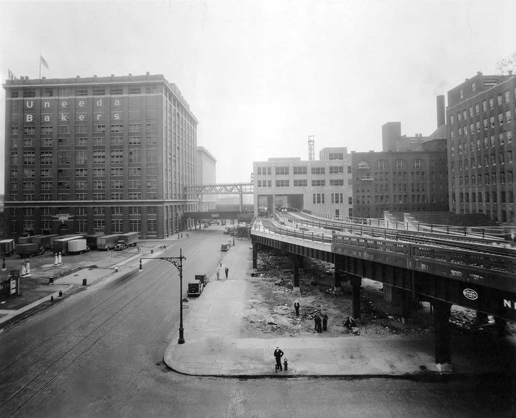
And finally, there’s Tim Maly’s excellent City Built on a Dredge – more on NYC, the made landscape and water. Mr. Maly looks at evacuation maps, too – much of the red at the tip of Manhattan Island is new land made of spoils from dredging. One (railfan’s) quibble: “The High Line is an architectural marvel made possible by the dredging of Newark Bay.” should read more like “…the re-purposed High Line park…” – the High Line was there before and it was, in it’s original form, killed by the container (all of which I am 1000% sure Tim knows – as I said – quibble).

highline

* quote from Norman Maclean’s A River Runs Through It.


News note of community interest

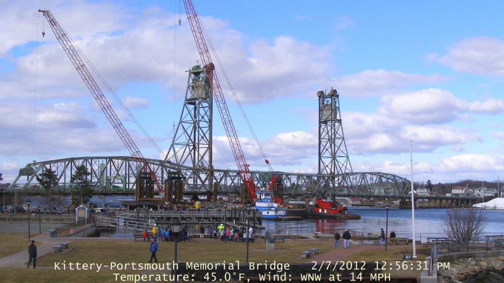
There’s currently a big move underway in Portsmouth (NH). The center lift span of the Memorial Bridge is scheduled to be floated off sometime withing the next 72 hours. The bridge has been closed (structural deficiencies) for months – a new one is on tap with a completion date in 2014. You can watch a web cam here; I’m going to head into town tonight to take some pictures. For folks who don’t know the area, the tide really moves through this section of the river. I imagine they’re going to do the fine positioning of the barge Cape Cod at high tide and let the going tide help float her away.

A day in the woods

Photos, with commentary.

Clematis seed heads (I’m thinking Clematis virginiana).

*

Witch Hazel (Hamamaelis virginiana)

aka

Pistachier Noir

With a nod to NH Franco-American culture, tan seed capsules each carry one or two small shiny black seeds reputed to be edible with an oily pistachio flavor. *

*

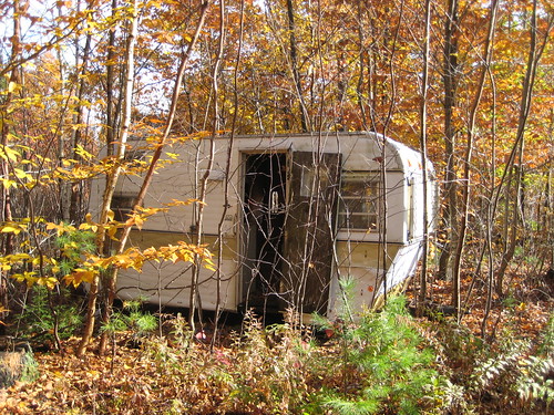
Near a landing – I’m thinking abandoned logger’s office/shelter.

*

Beaver pond (handheld) panorama. Click on the image below to embiggen moderately; click here for the full boat.

*

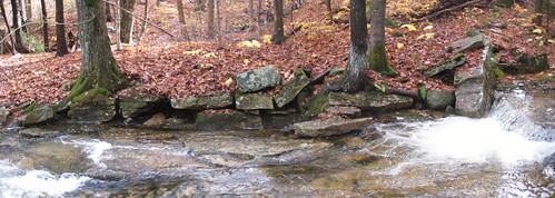
In the mid 1800’s, the majority of New England was deforested. You find evidence (stone walls, cellar holes) everywhere – even deep in what is now regrown forest. I found what looks to be the remains of a sawmill foundation and millrace yesterday, miles from the nearest 2 lane road (and a half mile from the nearest tote road).

*

A short video of the site – as much for the sound effects as anything. Cameo by the lovely Dinah.

Institutional Collapse

*

Who lived in a pineapple under the sea?

SpongeBob! SquarePants!

Who died in an oil spill because of BP?

SpongeBob! SquarePants!

*

http://www.guardian.co.uk/world/2010/may/30/india-heatwave-deaths *I see the climate-crisis massacres are recommencing

*Maybe atmospheric scientists made up all those dead Indians for money, and invented the oil spill, too

http://www.wmo.int/pages/mediacentre/press_releases/pr_869_en.html *Good thing a cold snap on K Street equals a cooler world

9-11, Enron, Iraq, Katrina, mortgage crisis, bailout, euro crisis, climate crisis, oil spill — we’re led by liars and sleepwalkers

Every major event that hits us is a fake, a fraud, a provocation, a panic or an organized denial — never anything we foresaw or averted

We’re way past the point of rationally managing events and into a business and politics of “lemming retention”

*And I’m not even angry — I’m saving my temper for the endless, ugly, Soviet-style ordeal of watching the Gulf Coast drown in tar

– tweets from @bruces (Bruce Sterling)

I’m not in the ‘it’s our (collective) fault’ camp. Yes, it’s impossible to argue that our oil addiction is not at the root of the Gulf disaster. But we, as a civilization, do a lot of things that involve risk – develop drugs, fly aircraft, drill and refine oil – and we have institutions/mechanisms in place that are supposed to mitigate these risks and ensure that there are good plans for when things go pear-shaped. The proximate cause of the Gulf spill (wrapping safety issues, inspection issues, lack or inadequacy of disaster planning into one package) is regulatory capture. Interior’s Minerals Management Service was not doing their job, to put it mildly. To paraphrase, power elites have always been with us, but it seems that in the past 15 years or so the world has gotten tougher to manage, while the (American, at least) power elite, aka Villagers, has become populated by nepotistically placed incompetents. If we’re going to make it through the crisis bottleneck that looms, we need to do better. My suggestions:

  • Go local. Though it’s like trying to change the course of a supertanker by hitting it with a feather, it needs to be done. Garden. Gather. Walk. Find your local farmer’s markets.
  • Learn whats up. One of the most dangerous trends of the past couple of decades has been the complete collapse/capture of the traditional media who are now fluffing power like there’s no tomorrow (with any luck, for many of them there won’t be – see Newsweek). There are people committing acts of journalism – mostly on the web. Seek ’em out. Look for who can back assertions up with facts.
  • This one may get me in trouble – vote. The government (local, state, federal) is _our_ tool. Although corporations are people (a court decision I’ll never understand), they can’t vote. If your Senator represents Big Oil or Wall Street or the RIAA/MPAA more effectively than s/he represents your interests primary her (if D) or vote him out (if R). Sorry conservatives – if you are firm in your beliefs and honest about what’s going on , it’s third party (and NOT teatardism) for you. Although both parties are well integrated into the oligarchy, one (R) is a bought and paid for subsidiary of corporate power.

I’d love to see full cleanup costs extracted from, and Clean Water Act fines levied against, BP. If that means BP’s US assets are auctioned off and the company ceases to do business in this country, all the better. It would be a salutary lesson for many large entities.

Waze, Foursquare and location based social media

I may have a chance to consult/volunteer/help out with a project that combines elements of social media, augmented reality, bar coding, street art, locational stuff and probably a couple other things. So… I figured I’d better take the plunge and get a Foursquare account set up. Foursquare is an app that let’s you check in from various venues (including bomb scare sites >grin<) – the idea is that if you’re out for a night on the town, friends can track you down easily. Once they’ve done that, the mini-mob shows up as being together and additional friends might be motivated to jump in. At least as important as the ‘find me’ aspect (based on what I’ve seen of real world use)  is, first, the game aspect of foursquare and, second, tweeting “I’m here” as part of your general tweetstream. Foursquare hands out badges (not real ones – for real Foursquare badges, Nerd Merit Badges has your back) – there’s a certain amount of competitive jockeying for Mayorships and the badges deliver some positive feedback for Foursquare use.

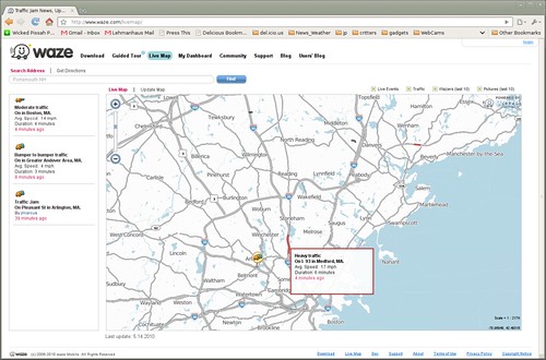
Foursquare is at its best when combined with a location-aware phone – you can check in with any phone that has either a data plan or text capabilities, but it’s a bit cumbersome. My phone (Nokia E71x) has a GPS, but there’s no native Foursquare app for the Symbian operating system. A quick google turned up Waze, which describes itself as “a social mobile application providing free turn-by-turn navigation based on the live conditions of the road.” Waze is a crowdsourced route and driving conditions system – fire up Waze on your phone, drive around and the Waze client uploads info about where you are, how fast you’re moving etc. It can then ‘see’ slowdowns, traffic jams etc. It also allows you to explicitly report accidents, speedcams, etc. and -important for my original purpose- you can use it to check in on Foursquare. Original purpose aside, it is a really cool idea – instead of some central authority issuing traffic advisories, the traffic itself does the monitoring.

A few thoughts/links:

  • “One relatively recent and very simple intervention, made possible by the lamination together of three or four different kinds of technology, has completely changed what a map is, what it means, what we can do with it.
    It’s this: that for the very first time in human history, our maps tell us where we are on them.
    The fact that such depictions can now also render layers of dynamic, real-time situational information seems almost incidental to me compared to this. This one development subtly but decisively removes the locative artifacts we use from the order of abstraction. By finding ourselves situated on the plane of a given map, we’re being presented with the implication that this document is less a diagram and more a direct representation of reality — and, what’s more, one with a certain degree of fidelity, one that can be verified empirically by the simple act of walking around. How is that not epochal?” *
  • More AG on video game rewards meet social media: “Schell’s argument (or one of them, anyway) is that the everyday environment is now sufficiently instrumented and internetworked that the psychological triggers and incentives developed by game designers to motivate in-game behavior can be deployed in real life. […] And this is more than passing scary, because these motivators work. Just as food designers have figured out how to short-circuit our wetware with precisely calibrated doses of fat, salt and sugar, game developers trip the dopamine trigger with internally-consistent, but generally otherwise worthless, symbolic reward systems. That they’ve (knowingly or otherwise) learned how to play this primordial pathway like a piano is attested to by the untold gigahours gamers worldwide spend voluntarily looping out the most arbitrary actions, when most of them presumably have a choice of other pretty swell things they could be doing.” *
  • And, of course, the whole privacy-control thing (I’m linking those 2 concepts because I agree with others that the crux of the biscuit is control – my control over my info stream is the key). I don’t mind that twitter sees that I’m out having brunch (presumably the dogs, the array of automated claymores (“Front Toward Enemy”!) and the genetically engineered sentient whip-hawthorns will cause burglars to leave the house be), but I’d mind very much if state troopers had real-time location and speed data on me as I drove around.

An aside on privacy: Facebook has been -justifiably, in my opinion- getting pummeled for its approach to privacy. Partially in reaction, the Diaspora project has been getting a lot of attention – like receiving $174,339 towards a goal of $10,000 on kickstarter (you read that right). Enthusiasm for a Facebook replacement is high, but here’s a post arguing that Diaspora may be cursed by early success.

The Changed Media Landscape

A I write this there’s a bit of weirdness going on over in the metropole (Portsmouth) – it’s unclear exactly what is happening, but it involves a bus, a 911 call reporting a suspicious package/device, local and state police, AFT agents and robots. I found out about it via Twitter  about 15 minutes after police showed up and it became obvious to local folk that something was up (around noon today). Some of the things I’ve noticed since then:

  • It didn’t take long for a hashtag – #03801bomb – to be declared. Click on the tag to go to the Twitter search page for the latest tweets.
  • There was a steady stream of information, photography, video and comedy all afternoon. I knew when folks started leaving the bus within minutes thanks to @WireNH (I picked the tweet that combined news and the funny).
  • A video taken by @Bill_Lord of one of the bombbots unloading got picked up by a Boston newscast.
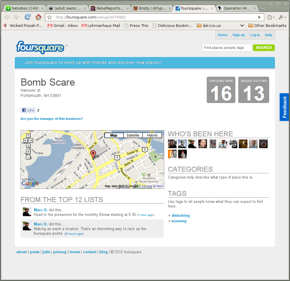
  • Sometime during the afternoon, a foursquare (location sharing social media app) venue got set up.

*

  • Dan did a bit of livestreaming from his mother-in-law’s living room – which happened to be across the street from the bus.
  • I saw at least one tweet that referenced UStream – another livestreaming app. Keep in mind, all you need in order to go live from virtually anywhere is a decent cell phone and tiny tech chops.

I caught some of the teevee coverage as well. The informal coverage was better – much better. Nobody (I suspect, including many of the cops on scene) knew what was going on – last I looked, we still don’t. That didn’t stop NECN – or the crowd watching – from covering it, nor should it have. Instead of the 2 or three stills and speculation/repetition of a very few facts that the teevee was offering, the crowd supplied more pictures, bad jokes and updates when something actually happened. I got much more of a sense of the situation from the ‘new’ media feed. The landscape may change further, but believe me, the ‘changing media landscape’ has already changed.

Map Kibera

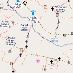
Kibera in Nairobi, Kenya, widely known as Africa’s largest slum, remains a blank spot on the map. Without basic knowledge of the geography and resources of Kibera it is impossible to have an informed discussion on how to improve the lives of residents. This November [2009], young Kiberans create the first public digital map of their own community.

Map Kibera.